News
Prof El-Mowafy won another ARC Discovery Project!
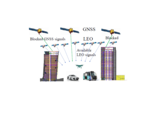
A Discovery from Ahmed El-Mowafy entitled “Next-generation Navigation by Mega-constellations LEO satellites” has been funded by the Australian Research Council (ARC). This research will explore a novel positioning approach using new mega-constellations low-earth-orbit satellite communications signals to address a severe limitation of Global Navigation Satellite Systems (GNSS).
LEO POD at Ginan software
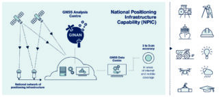
GNSS-SPAN has signed a collaborative agreement with Frontier SI, Geoscience Australia, and the University of Newcastle to develop the feature of precise orbit determination (POD) for the LEO satellites at Ginan software. This will help the Ginan users to perform the state-of-the-art kinematic and reduced-dynamic POD for LEO missions, including GRACE-FO, Sentinel, COSMIC-2, Spire CubeSats, etc. The precise orbits are required for various applications such as satellite gravimetry, altimetry, InSAR, radio occultations, LEO PNT, space rendezvous and docking.
From the GNSS-SPAN group, Dr Amir Allahvirdi-Zadeh and Prof. Ahmed El-Mowafy will work on this project.
ION-Winter2023 newsletter (Page 13)
TOP 250 RESEARCHERS
Curtin University’s Peter Teunissen is the first in two research fields
Curtin University senior professor Peter Teunissen has seen the field of satellite technology expand at a phenomenal rate over the past few decades.
From a distance of thousands of kilometres, satellites can now help detect ore deposits on Earth, determine the moisture content of soil for better crop planting, provide instant navigation assistance for walkers and motorists, accurately predict weather patterns and ensure that no-one with a satellite-connected device will ever be truly lost again. A car can be tracked across a desert, a military expansion documented and a glacier’s retreat observed minute by minute and in intimate detail.
Today, dependence on global navigation satellite systems (GNSS) has penetrated all levels of society, says Teunissen, who is named in The Australian’s 2021 Research magazine as Australia’s top research in two fields — in geophysics and in radar, positioning and navigation.
“The timing systems we are using for computers, the synchronisation of timing – that’s all linked to GNSS,” he says. “All those satellites are equipped with the most accurate atomic clocks. We are all now dependent on those GNSS systems.”
Awarded an Australian Research Council Federation Fellowship, the precursor of the current ARC Laureate Fellowship, Teunissen moved to Australia more than a decade ago. He has been associated with Curtin University since 2009 and he is now an award-winning and internationally-recognised expert in the field of satellite technology, specialising in interferometric GNSS, the use of satellite signals for the high precision measurement of the parameters of water and land masses.
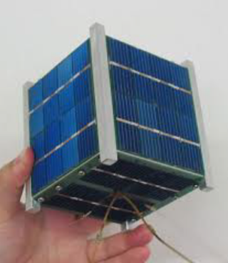
The new frontier of miniaturised satellites has also caught Teunissen’s attention. Called CubeSats – and often not much larger than a loaf of bread – the mini-satellites are within the economic reach of universities and corporations.
“A lot of research at the moment is focused on the next generation of GNSS satellites; one segment is looking at lower-cost satellites, such as CubeSats,” he says. “The CubeSats really are the future for increasing the number of satellites and constellations because even students, of course with proper supervision, are able to design satellites and then they can be launched with a much lower budget.”
Teunissen has been fascinated by the potential of satellite technology from the field’s earliest days. As a professor of geodesy, classically the study of the earth’s shape and surface, in the early 1990s he was invited to choose his own specialisation at the Delft University of Technology in the Netherlands.
He looked to the emerging field of satellite technology and discovered that his homeland had no GPS know-how, no GPS infrastructure and no GPS equipment. He used generous grant funding the Netherlands’ Royal Academy of Sciences to buy the nation’s first GPS receiver for US$300,000. As a demonstration of the rocketing speed of the field’s development, he says that nowadays such a GPS receiver might cost US$100.
Developed by the US military, GPS was the first of the global navigation satellite groupings, and now all but one of the systems, four global and two regional, work with potentially difficult hybrids of military and civilian control, Teunissen says.
The US military, for instance, retains an interest in the GPS system, Russian military interests prevail with the GLONASS Russian GNSS system, and China exerts control over the nation’s BeiDou system. “Of the global systems, only the European system, Galileo, which became operational last year, is entirely a civilian operation,” Teunissen says.
Each system has an average of 30 satellites orbiting at an altitude of about 20,000 kms, and between them they cover every square centimetre of the earth’s surface. The civilian side of GNSS is “broad, open, transparent; working with and improving systems”, Teunissen adds, but military forces can have different priorities. During the Iraq war, for instance, the US military ensured the GPS covering Iraq was limited to US military use.
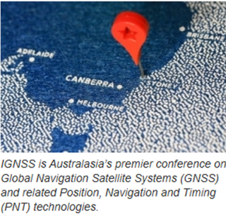
IGNSS2020 Keynote by Professor Peter Teunissen
It has become hard to imagine a world without Global Navigation Satellite Systems (GNSSs). As we increasingly rely on their enabling services, we become equally vulnerable to their threats. These threats can have a huge impact, particularly when the integrity of GNSS is at stake and hazardously misleading information is provided.
To underline the importance of GNSS-Integrity, Professor Teunissen presented his Keynote speech at the recently held IGNSS 2020 conference on the topic of integrity in the GNSS-context. His presentation ‘GNSS Integrity: A Kaleidoscope of Challenges and Opportunities’ gave an overview of the many GNSS integrity challenges and opportunities that exist. It thus presented samples of fertile grounds for the typical researcher (PhD student, Postdoc or Professor alike) who is eager to take up a difficult challenge and/or looking for research opportunities in the field of GNSS-integrity that can make a difference.
Examples of some of the topics addressed are how to battle zero-integrity, how to choose between detection and identification, how integrity is affected by distributed processing, how next-generation GNSSs can offer better integrity and how to understand the integrity of integrity.
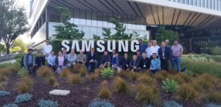
Multi-GNSS PPP-RTK Workshop for Samsung USA by Professor Peter Teunissen
In May 2019 Professor Teunissen presented a 3-day workshop at the Samsung Strategy and Innovation Center in San Jose, CA USA. The workshop “Multi-GNSS RTK, PPP, PPP-RTK: Theory, Methods and Results” covered an overview of multi-frequency multi-GNSS (GPS, GLONASS, Galileo, BDS, QZSS, NavIC); Theory and methods of integer ambiguity resolution; Real-time kinematic (RTK) positioning; Theory and methods of carrier-phase ambiguity validation; Precise point positioning (PPP) and PPP-RTK for network providers and users; Constrained RTK and array-aided PPP-RTK, together with various world-first results on multi-GNSS.
SSSI postgraduate award 2019 for Dr Safoora Zaminpardaz
The Surveying and Spatial Sciences Institute (SSSI) awarded the 2019 Postgraduate award to Dr Safoora Zaminpardaz for her pioneering research project conducted at Curtin’s GNSS Research Centre in the analysis of GNSS applications in Australia. Safoora showed innovation in testing novel combinations of satellite signals from different systems and analysing individual systems for their unique characteristics. She has been the first researcher in Australia to extensively analyse the data and models of the Indian NavIC system and investigate its potential capabilities over Australia. She also became a world-first researcher who demonstrated the quality of future GLONASS CDMA using an ingenious multi-epoch measurement approach.
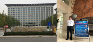
Prof Teunissen Invited Presentation at Chinese Academy of Space Technology (CAST)
In September 2018, Peter Teunissen was invited to give a presentation at the Chinese Academy of Space Technology in Beijing, China. In his CAST presentation Multi-GNSS for Science and Engineering, Peter presented a personal journey through the various important scientific and engineering applications of multi-GNSS research, whereby also an outlook was given to some of the exciting research challenges lying ahead of us.
New ARC Discovery Project: Tracking Formation-Flying of Nanosatellites Using Inter-Satellite Links
Formation flying, based on distributed miniaturized satellites, such as Cubesats, is envisioned to revolutionise the way the space-science community conducts autonomous missions. The project will develop a purely kinematic concept for differential orbit determination of the Cubesats, exploiting the full capabilities of GNSS carrier-phase measurements for precise orbit and attitude determination; and an extension to more complex formation configurations. The project will also pioneer the use of the satellite based augmentation systems (SBAS) in this application, supporting the future Australian SBAS program, and the development of integrated algorithms, e.g. space-based Precise Point Positioning with fixed ambiguities supported by SBAS.
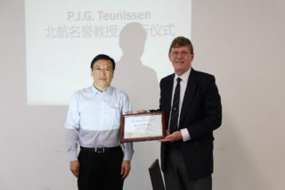
Beihang University Confers Honorary Professorship to Professor Peter J.G. Teunissen
On the afternoon of September 26th 2018, the appointment ceremony for Peter J.G. Teunissen as an Honorary Professor of Beihang University was held. Those who attended the ceremony included Tao Zhi, Vice President of Beihang University, Yang Lijun, Dean of the School of Astronautics, Weng Jingnong, Dean of the International School, Dong Yunfeng, Vice Dean of the School of Astronautics, and others. Huang Hai, a profess.or of the School of Astronautics, presided over the ceremony. During the ceremony, Vice President Tao gave a speech congratulating Professor Teunissen for his scientific contributions to space navigation and issued the letter of appointment to him.

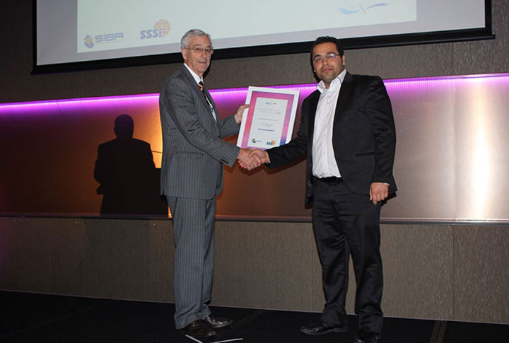
WASEA Excellence Award 2015 for PhD Student Amir Khodabandeh
The Western Australian Spatial Excellence Awards (WASEA) celebrate the achievements of top spatial information enterprises and showcase the finest projects that the Western Australian Surveying and Spatial Industry has to offer.
Projects and individuals attaining recognition at this premier event are deemed to be truly outstanding achievers and pre-eminent in their field.
PhD student Amir Khdoabandeh of Curtin’s GNSS Research Centre received this year’s Postgraduate student WASEA Excellence Award for his thesis on PPP-RTK. In his thesis, Amir provides a methodical and thorough approach to formulating a transformational framework for a novel method to PPP and RTK, the PPP-RTK, combined with rigorous mathematical derivations of the processing algorithms, and demonstrated with extensive performance evaluations. Most importantly, the generality of Amir’s methods make his results directly applicable to the different next-generation GNSSs, such as modernized GPS (US), BeiDou (China), Galileo (EU), QZSS (Japan) and IRNSS (India).
WASEA is jointly hosted by the two organisations that created the concept and actively promote it: the Spatial Industries Business Association (SIBA) and the Spatial Sciences Institute (SSSI).
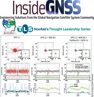
Multi-GNSS Precise Positioning: New Solutions, New Challenges
Appeared in Inside GNSS – Issue November/December 2014
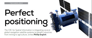
Perfect positioning
Appeared in CRCA Know How Magazine – Issue 3, September 2014
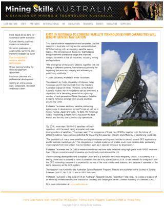
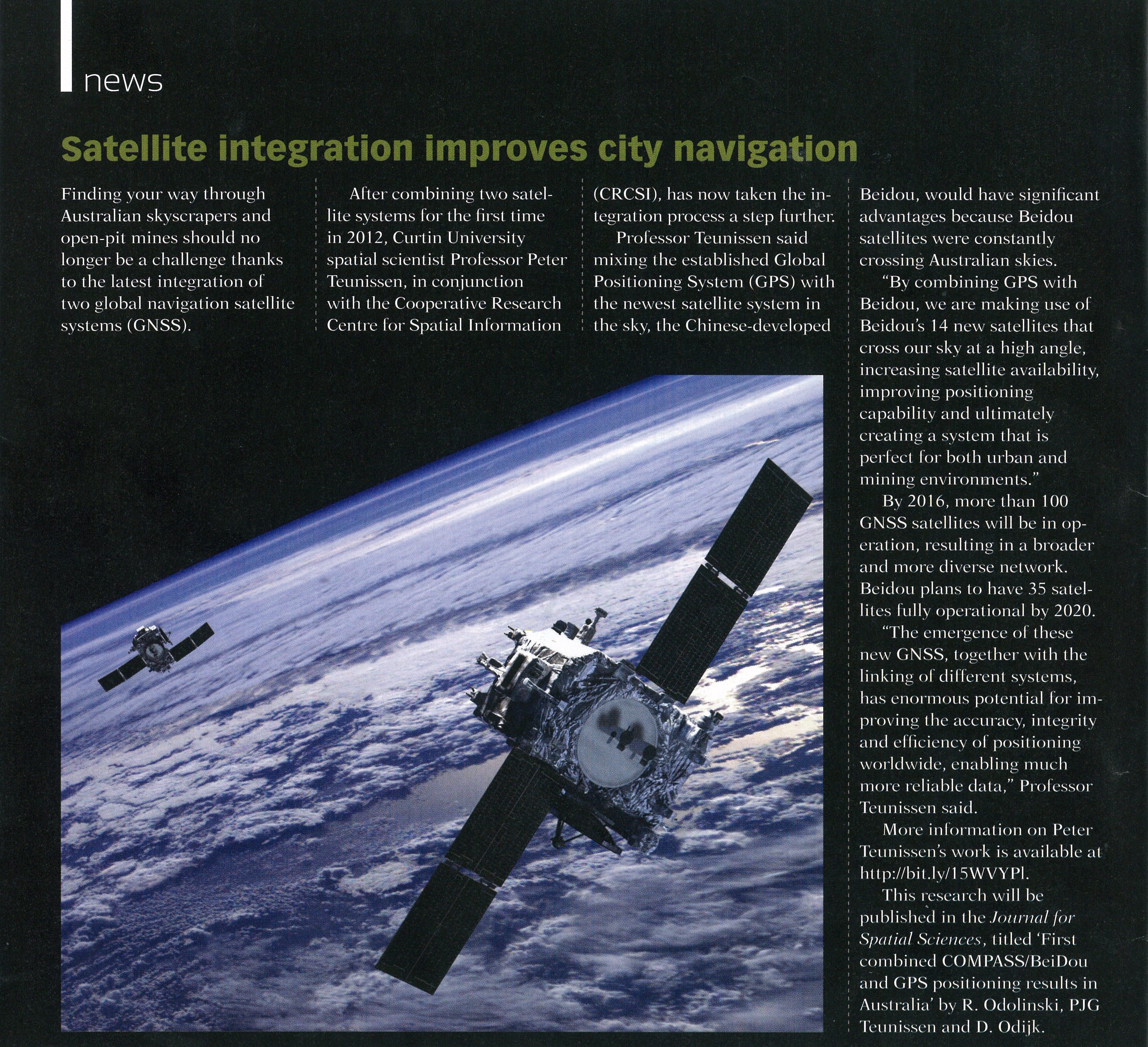
First in Australia to Combine Satellite Technologies New Capabilities will Benefit Mining Navigation
Appeared in Mining Skills Australia – A Division of Mining & Technology Australia, 2014

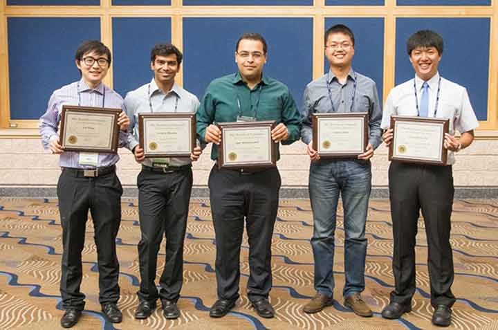
ION PhD Student Award for Amir Khodabandeh of Curtin’s GNSS Research Centre
Each year, the Institute of Navigation (ION), founded in 1945, organises the world’s largest international technical meeting of GNSS technology. This event has been hosted on an annual basis for the past 27 years and is attended by over 1500 navigation professionals and engineers from over 40 countries.
As a part of the GNSS conference’s technical program, the institute sponsors a competitive student paper contest. Technically elite students from around the world author technical papers on satellite navigation and positioning for the opportunity to present their papers at the conference, have it published in the conference proceedings and have their conference travel expenses paid by the institute.
Mr. Amir Khodabandeh of Curtin’s GNSS Research Centre (see photo) is one of only five students being awarded this prestigious ION-prize. The award carries high academic prestige, as many prior-year student award winners have become visible leaders in the engineering filed of navigation and positioning.
ESA Recognizes First Galileo Navigation Fixes By Curtin GNSS Research Centre
Curtin GNSS Research Centre received certificate from European Space Agency (ESA) in acknowledgment of early Galileo results.
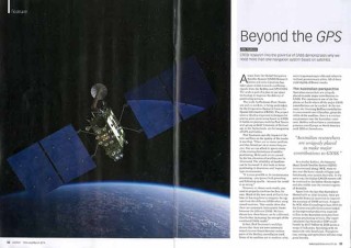
Beyond the GPS
Appeared in Position – The Australian magazine of surveying, mapping & geo-information, pp 32-34, Issue 69, February/March 2014
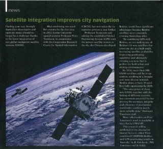
Satellite integration improves city navigation
Appeared in Position – The Australian magazine of surveying, mapping & geo-information, Page 8, Issue 67, October/November 2013
