IGS Multi GNSS Experiment
IGS Multi GNSS Experiment (IGS M-GEX) is an international effort aimed at improving the operations related to the upcoming global navigation systems. The final goal is to operate a global network capable of tracking new signals in addition to GPS and GLONASS.
The GNSS-SPAN Group at Curtin University participates in such an effort by providing raw data and analysis software. The main purpose of IGS M-GEX is to conduct global multi-GNSS signals tracking experiment in parallel to the regular IGS operations, to focus on tracking the newly available GNSS signals. This includes all signals from the modernized satellites of the GPS and GLONASS systems, as well as for the first time in IGS operations, all available or applicable signals of the Compass/BeiDou, Galileo and QZSS systems and any space-based augmentation system (SBAS) of interest.
Equipment, data description, and analysis software
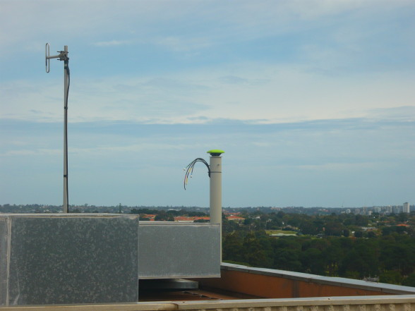
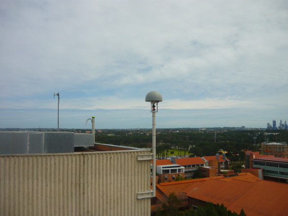
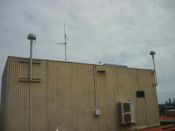
The IGS station CUT0 59945M001, which is also part of the APREF network, is located in Bentley Campus, is providing a continuous data stream to the IGS. The antenna is located at: latitude -32 00 14.0, longitude +115 53 41.2. The antenna is connected through a signal splitter to three high-quality geodetic type receivers: Trimble NetR9, Septentrio PolaRx4 PRO, and Javad TRE_G3TH_8. These receivers are multi-frequency multi-system GNSS receivers. For the purpose of data collection for the IGS M-GEX campaign as an observing site, Trimble NetR9 is used as the main tracking receiver, with the other receivers (namely CUT1 Septentrio, CUT2 Trimble, and CUT3 Javad) as a backup and for research purposes. For short baseline tests, five other stations are also used, CUTA, CUAA, CUAI, CUTB and CUBB.
Equipment
- Antenna: TRIMBLE TRM59800-00 SCIS mounted on a steel mast.(CUT0, CUTA, CUTB)
- Receiver: Trimble NetR9 (CUT0).
- Receiver: Septentrio PolaRx4 PRO (CUT1).
- Receiver: Trimble NetR9 (CUT2).
- Receiver: Javad TRE_G3TH_8 (CUT3).
- Receiver: Trimble NetR9 (CUTA)
- Receiver: Javad TRE_G3TH_8 (CUAA)
- Receiver: Septentrio PolaRxS (CUAI)
- Receiver: Trimble NetR9 (CUTB)
- Receiver: Javad TRE_G3TH_8 (CUBB)
Data provided
- GPS, GLONASS, GALILEO, QZSS, BDS data, daily RINEX 30 seconds sampled, format 3.x
Curtin Data can be downloaded here.
Analysis software
- Study of Inter System Biases.
- Data Quality Control.
- Analysis of noise.
Coordinates
Precise ITRF2014 coordinates for the CUT0 antenna (SINEX) can be found on the Geoscience Australia website.
Study of Inter System Biases
A complete characterization of the Inter System Biases is essential for an efficient combined multi-GNSS processing. Thanks to our equipment and our software, we stuied Inter System Biases under the following scenarios.
- L1-E1 ISB estimation for CUT0 (Trimble receiver) – CUT1 (Septentrio receiver) based on all GPS satellites and GIOVE-A/B in view.
- L1-E1 ISB estimation for CUT0 (Trimble receiver) – CUT2 (Trimble receiver) based on all GPS satellites and GIOVE-A/B in view.
- L1-E1 ISB estimation for CUT0 (Trimble receiver) – CUT3 (Javad receiver, only L1 frequency) based on all GPS satellites and GIOVE-A/B in view.
- L5-E5a ISB estimation for CUT0-CUT1 based on GPS PRN1/25 and GIOVE-A/B in view
- L5-E5a ISB estimation for CUT0-CUT2 based on GPS PRN1/25 and GIOVE-A/B in view
Results are cross-validated through the use of two independently developed software. A network processing software based on Kalman Filter and DIA data screening (KALDIA) and an attitude determination software based on constrained LAMBDA (MCLAMBDA).
Network processing software (KALDIA)

KALDIA processing for monitoring of GPS-Galileo inter-system biases. Input files are the daily RINEX observation files (30-sec sampling interval) and RINEX navigation file. RIN2MAT is run for pre-processing (reading and selection of data plus computation of satellite positions). GNSS_KALDIA is run on a single-frequency epoch-by-epoch basis without coordinate estimation (zero baselines). Output is formed by a daily report per receiver pair per frequency.
MC-LAMBDA processing for monitoring of GPS-Galileo inter-system biases. Input files are the daily RINEX observation files and RINEX navigation files. First MC-LAMBDA is run on a single-frequency epoch-by-epoch basis with (zero baseline constraint). Estimated double difference ambiguities are then used to estimate the ISBs. Finally, an estimate is formed by a daily report per receiver pair per frequency.
Data quality control
This utility performs quality control of GNSS observations using a single-receiver single-satellite undifferenced observations approach utilizing the DIA Method. The software scans all system observations (GPS + Galileo + GLONASS + COMPASS + SBAS + QZSS) collected at CUT0 and DLF1 and cleans the data from observations with outliers. Scanning is performed satellite-by-satellite, for all satellites in view and for all observation types (L1, L2, L5, L5a, L5b, L5a+b, L6, etc.). Currently, DIASC is running in the local case (i.e. testing observations in the current epoch). The software provides:
- RINEX file that is a replica of the input file after removing data with outliers and cycle slips (down to the MDB values).
- A summary file of error detection results by DIASC. The file gives, for each observed satellite, the satellite PRN, total number of observed epochs, number of epochs with detected outliers, and percentage of the removed data with respect to the original data.
- A text file including the epochs of detected errors and their satellites.
- Detection index (showing instances when detection of blunders takes place).
- Minimal Detectable Biases (MDB).
- LOM-test values (F-distribution), their histograms, and P-values of the LOM.
- W-test values per observation and their histograms.
Data Screening software (DIASC)

Data Quality Control Software. Input files are the daily RINEX 2 or RINEX 3 observation files.
Analysis of noise characteristics for various combinations of single frequency GNSS observations
The Geometry-free analysis (GFA) software, developed in collaboration with Delft University, is used to study GNSS signals under the following scenarios:
- Standalone receiver: CUT0 (Trimble); undifferenced code-minus-phase observable
- Zero baseline CUT0 (Trimble) – CUT2 (Trimble); single difference and double code-minus-phase, and double difference phase observables
- Zero baseline CUT0 (Trimble) – CUT2 (Trimble); single difference and double code-minus-phase, and double difference phase observables
- Short baseline CUT0 (Trimble) – CUTA (Trimble); single difference and double code-minus-phase, and double difference phase observables
Geometry Free Analysis software (GFA)

GFA processing for analyzing of GPS-Galileo noise characteristics. Input files are the daily RINEX observation files and RINEX navigation file.